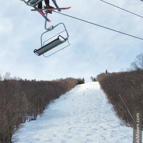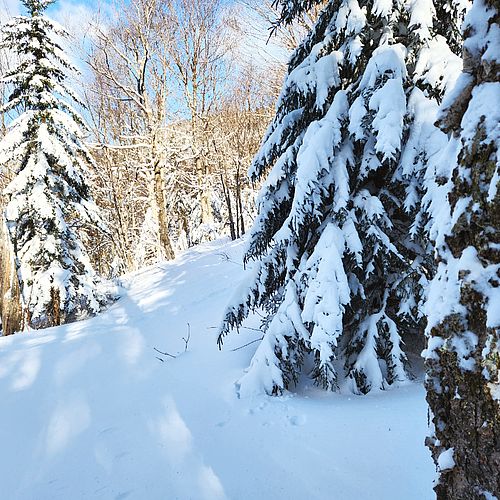
Several Vermont ski resorts are reporting about 10 inches or so of new snow over the last 24 hours. Yee-ha!
But with all this snow has come quite a bit of wind, so check with your favorite resort to see what lifts are open; many of the high lifts were on wind hold this morning. Visit my <link internal-link>Vermont Ski Resorts page for links to snow and lift reports.
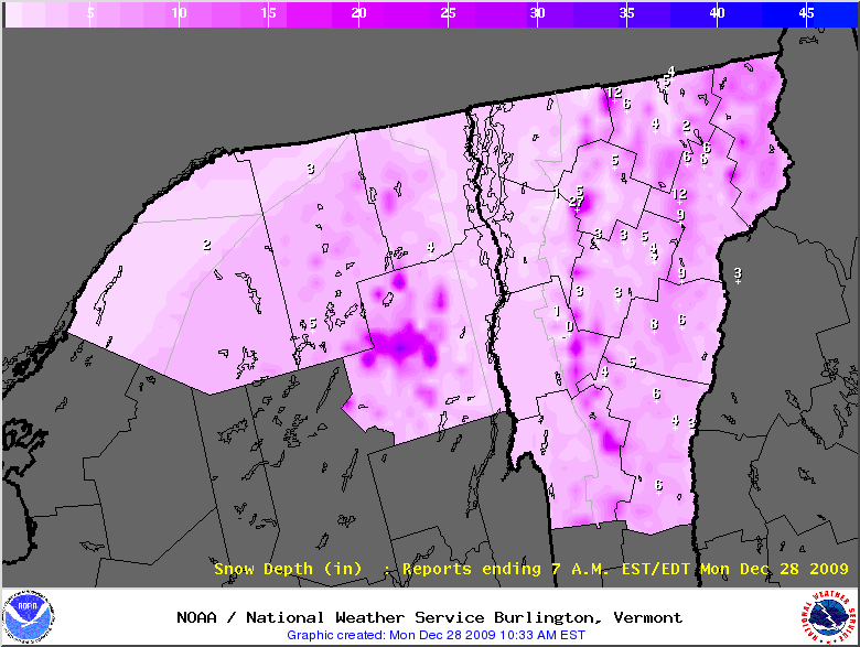
Here's a recap of snowfall from the National Weather Service/NOAA. Keep in mind that many of these observations are taken in towns, not in the mountains.
9:16 AM EST TUE DEC 29 2009
THE FOLLOWING ARE UNOFFICIAL OBSERVATIONS TAKEN FROM THE TWO DAY
EVENT STARTING ON MONDAY DECEMBER 28TH...WHICH OCCURRED DURING THE PAST 24 HOURS FROM THE TWO STORMS THAT HAVE BEEN AFFECTING OUR
REGION.
VERMONT

...ADDISON COUNTY...
   LINCOLN 2.2 NW         9.5   802 AM 12/29   COCORAHS
   SALISBURY 2 N          3.2   745 AM 12/29

...CALEDONIA COUNTY...
   SUTTON 2 NE            7.5   744 AM 12/29   COOP
   SUTTON                 6.9   801 AM 12/29   COOP
   WALDEN                 4.0   818 AM 12/29   COOP
   SAINT JOHNSBURY        2.2   745 AM 12/29

...CHITTENDEN COUNTY...
   NORTH UNDERHILL       10.5   851 AM 12/29   NWS EMPLOYEE
   SOUTH BURLINGTON       6.9   755 AM 12/29   NWS OFFICE
   COLCHESTER             3.5   600 AM 12/29   SPOTTER

...FRANKLIN COUNTY...
   SHELDON SPRINGS        7.0   756 AM 12/29   HAM OPERATOR
   HIGHGATE               5.0   757 AM 12/29   HAM OPERATOR
   SAINT ALBANS           4.0   741 AM 12/29   NWS EMPLOYEE

...LAMOILLE COUNTY...
   EDEN 2 S               7.2   801 AM 12/29   COOP
   STOWE 0.2 SW           6.3   803 AM 12/29   COCORAHS
   JEFFERSONVILLE         5.0   810 AM 12/29
   MOUNT MANSFIELD        4.5   745 AM 12/29

...ORANGE COUNTY...
   CORINTH                5.2   742 AM 12/29   COOP
   CHELSEA 2 NW           3.0   830 AM 12/29   COOP

...ORLEANS COUNTY...
   JAY PEAK               9.0   744 AM 12/29   COOP
   NEWPORT                5.6   743 AM 12/29   COOP
   IRASBURG               4.5   833 AM 12/29   COOP

...RUTLAND COUNTY...
   KILLINGTON            13.0   821 AM 12/29
   RUTLAND                6.8   850 AM 12/29   COOP

...WASHINGTON COUNTY...
   NORTHFIELD 3 W         7.0   914 AM 12/29   NWS EMPLOYEE
   WATERBURY CENTER       6.5   754 AM 12/29
   WAITSFIELD 2 W         6.0   750 AM 12/29
   WATERBURY 3.3 NE       5.5   804 AM 12/29   COCORAHS
   NORTH CALAIS           3.0   735 AM 12/29
   MARSHFIELD 4.5 SW      2.5   805 AM 12/29   COCORAHS
   PLAINFIELD             2.1   751 AM 12/29

...WINDSOR COUNTY...
   BETHEL 4 N             6.0   743 AM 12/29   COOP
   ROCHESTER              4.5   744 AM 12/29   COOP
   NORTH SPRINGFIELD      2.0   742 AM 12/29   COOP
   NORTH HARTLAND LAKE    1.8   742 AM 12/29   COOP
   POMFRET 2.6 N          1.5   803 AM 12/29   COCORAHS
   CAVENDISH              1.4   800 AM 12/29   COOP
   LUDLOW 0.5 WSW         1.4   804 AM 12/29   COCORAHS
   WOODSTOCK              0.5   806 AM 12/29   COOP
<link http: www.erh.noaa.gov btv html snow.shtml> NOAA updates Daily Snowfall Maps on the following page at about 10:30 each morning: <link http: www.erh.noaa.gov btv html snow.shtml>www.erh.noaa.gov/btv/html/snow.shtml
Bundle up and enjoy the new snow!